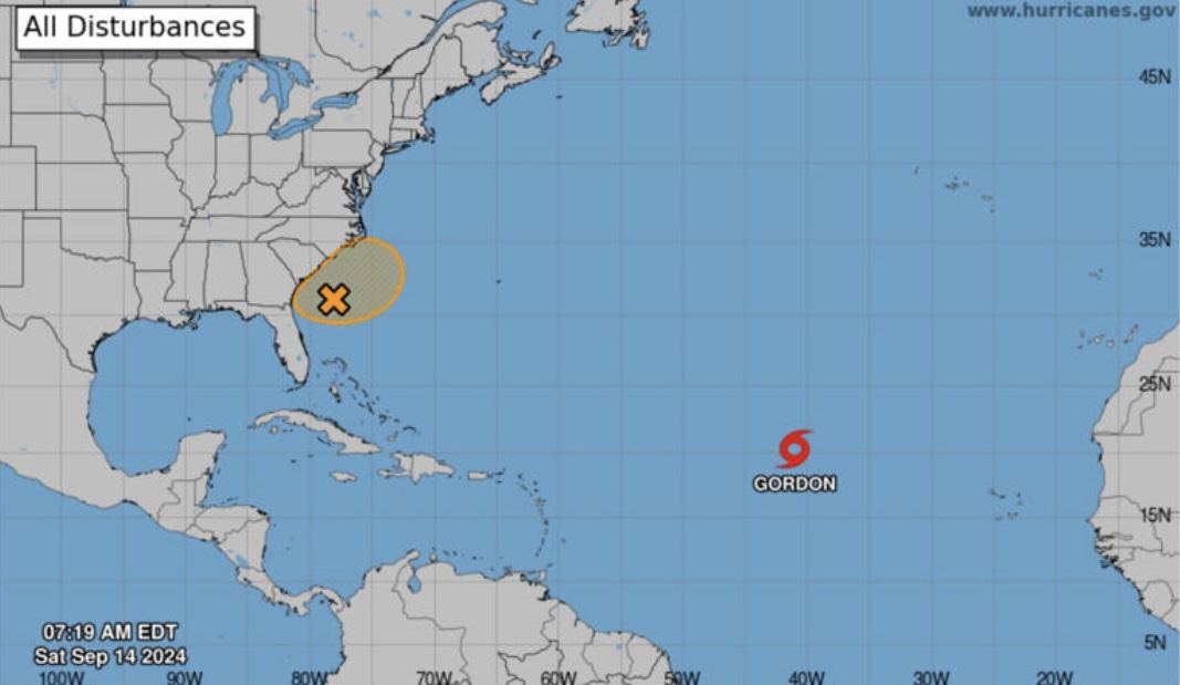
As the National Hurricane Center tracked Tropical Storm Gordon on Saturday, also being watched is a disturbance off the Southeast U.S., which may bring heavy rain and flash flooding to the Carolinas and Mid-Atlantic early next week.
Tropical Storm Gordon is expected to weaken as it moves slowly west-northwestward over the central tropical Atlantic Ocean the next several days, the center said. Now located about 1,145 miles west-northwest of the Cabo Verde Islands, which lie off the west coast of Africa, Gordon is moving at about 9 mph with maximum sustained winds of 45 mph.
Gordon is expected to become a depression by early Sunday and could gradually gain strength during the middle of next week. The storm is expected to remain at sea with no threat to land for at least the next week, AccuWeather forecasters said.
The developing “tropical wind and rainstorm” off the coast of the Southeast U.S., could develop into a tropical disturbance or storm early next week and bring coastal flooding, rip currents and beach erosion from northeastern Florida to the Delmarva Peninsula into next week, according to AccuWeather.
Any content which is considered unsuitable, unlawful, or offensive, includes personal details, advertises or promotes products, services or websites, or repeats previous comments will be removed.
User comments posted on this website are solely the views and opinions of the comment writer and are not a representation of or reflection of the opinions of TNN or its staff.
TNN reserves the right to remove, edit or censor any comments.
TNN accepts no liability and will not be held accountable for the comments made by users.

