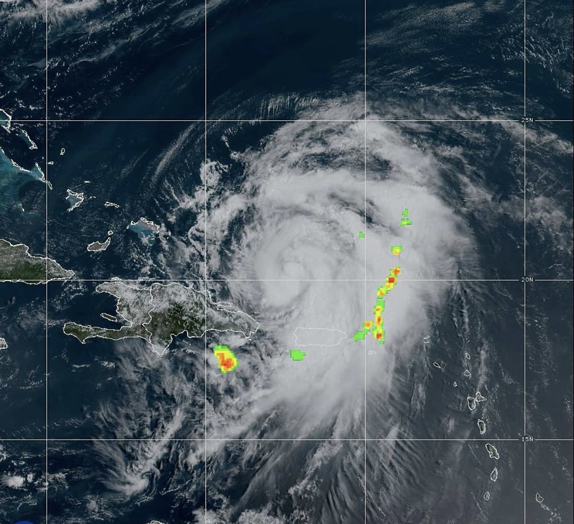
Despite encountering Puerto Rico’s towering mountains Tuesday night, Ernesto continued to gain strength and has the potential to rapidly intensify now that the storm is over open waters in the southwestern Atlantic. The next target for the powerful hurricane will be Bermuda this weekend, AccuWeather meteorologists warn.
The central pressure of the storm continued to drop Wednesday morning, which was a sign the storm was strengthening. Winds typically increase during and shortly after a drop in pressure.
2 p.m. EDT, Wednesday Ernesto was a Category 1 hurricane on the Saffir-Simpson hurricane wind scale with 75 mph maximum sustained winds while tracking away from Puerto Rico. The hurricane was just over 800 miles to the south-southwest of Bermuda.
“Further strengthening of Ernesto is anticipated, with rapid intensification possible over the next couple of days as the system encounters warm waters, moist air and low wind shear,” said AccuWeather Lead Hurricane Expert Alex DaSilva, “And as a result, we believe Ernesto will become a major hurricane of at least Category 3 strength prior to approaching Bermuda.”
Ernesto to pass close to Bermuda
The AccuWeather RealImpact™ Scale for Hurricanes in Bermuda is a 3. The RealImpact scale incorporates rain, storm surge and economic loss, in addition to wind impacts, rather than just the Saffir-Simpson scale, which only measures the wind intensity of a hurricane.
Rapid intensification occurs when maximum sustained winds within the storm increase by 35 mph or greater within 24 hours.
“Ernesto could pass within 100 miles of Bermuda on Saturday morning,” DaSilva said.
Depending on exactly how close the storm tracks to the islands, the strongest part of the hurricane — the eastern eye wall — could pass over the British Overseas Territory. While many of the structures on the island are made of stone and can withstand a formidable hurricane, power outages will occur, with the potential for significant property damage.
Depending on exactly how close the storm tracks to the islands, the strongest part of the hurricane — the eastern eye wall — could pass over the British Overseas Territory. While many of the structures on the island are made of stone and can withstand a formidable hurricane, power outages will occur, with the potential for significant property damage.
Ernesto will bring heavy rainfall to the islands of Bermuda. The rain will be intense enough to cause urban flooding and wash rocks and other debris onto roads that pass through the small hills.
Since rainwater is captured and used for drinking and other purposes on the islands, non-flooding rainfall is generally welcomed. From 4-8 inches of rain is forecast to fall in Bermuda, with an AccuWeather Local StormMax™ rainfall of 10 inches. Rainfall will be given a boost by the proximity of a non-tropical storm system nearby prior to Ernesto’s arrival.
After Ernesto’s encounter with Bermuda this weekend, the next stop for the hurricane will be Atlantic Canada. Even though the region is hit frequently in the winter months by powerful nor’easters, Ernesto could bring significant problems to the region.
“Ernesto could strike the island of Newfoundland or possibly even reach Nova Scotia, Canada, early next week,” DaSilva said.
A dip in the jet stream will be sharp enough to pull Ernesto on a more westerly path for a time, and that should be enough to cause landfall in Atlantic Canada.
Any content which is considered unsuitable, unlawful, or offensive, includes personal details, advertises or promotes products, services or websites, or repeats previous comments will be removed.
User comments posted on this website are solely the views and opinions of the comment writer and are not a representation of or reflection of the opinions of TNN or its staff.
TNN reserves the right to remove, edit or censor any comments.
TNN accepts no liability and will not be held accountable for the comments made by users.

