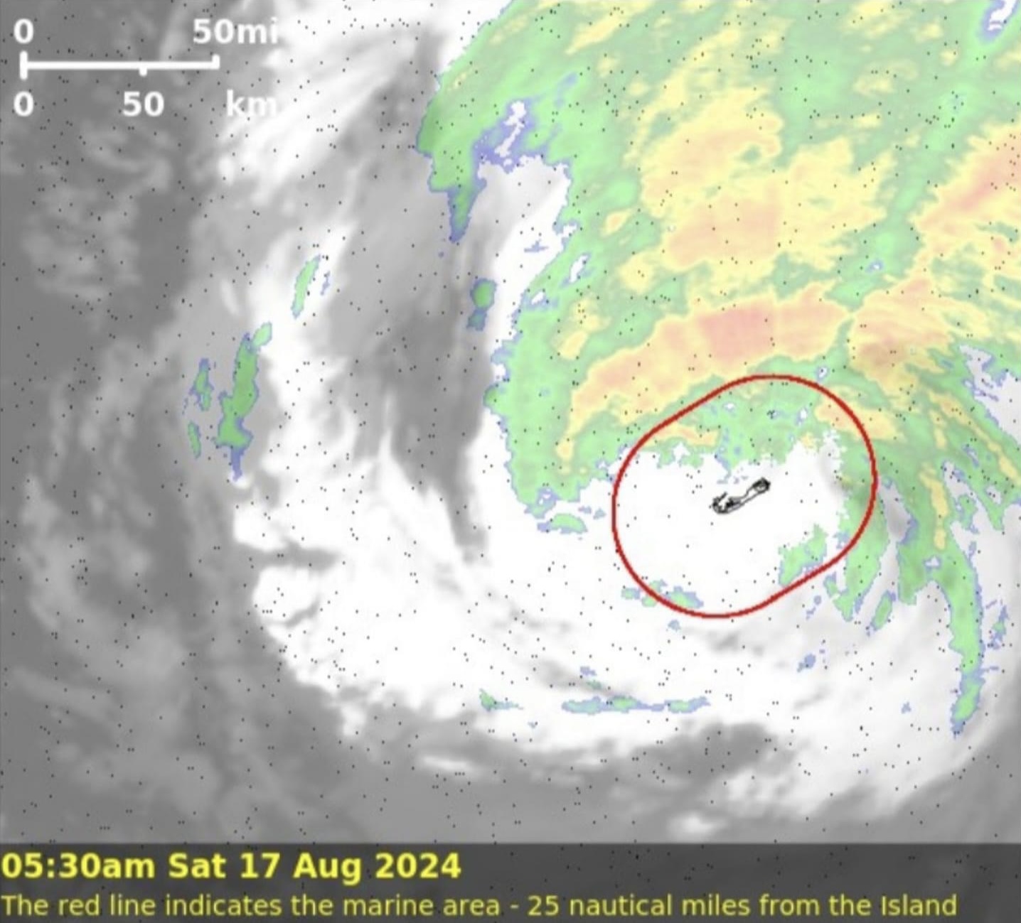
TNN News update on Hurricane Ernesto Kimberley Zuill social media page of the Bermuda Weather Service give us the latest.
West end winds on our NMB, Dockyard AWOS showing getting into the eye, whereas still blowing here at BWS on east side of of the Island.
Radar showing the skewed rainfall, nearly all on forward side of Ernesto… having been drawn ahead of it by converging with the frontal boundry that gave us plenty rain days before Ernesto’s approach.
The second half is gonna be a blow dry… (see composite image below that overlays satellite imagery) even though RADAR imagery shows no rainfall, we will still have a slow move through the southern quadrants of Hurricane Ernesto.
BELCO LATEST UPDATE
As of 6:00am today, we have the following storm-related outages to report:
Devonshire 2,264
Hamilton 2,696
Paget 2,520
Pembroke 4,460
Sandys 2,268
Smiths 1,477
Southampton 2,871
St. George’s 2,502
Warwick 4,298
We have a total of 25,356 customers experiencing an outage, which represents approximately 71% of our customers.
Stay inside, lots of debris and possible powerlines down. Stay safe and wait for the next update.
Any content which is considered unsuitable, unlawful, or offensive, includes personal details, advertises or promotes products, services or websites, or repeats previous comments will be removed.
User comments posted on this website are solely the views and opinions of the comment writer and are not a representation of or reflection of the opinions of TNN or its staff.
TNN reserves the right to remove, edit or censor any comments.
TNN accepts no liability and will not be held accountable for the comments made by users.


